Ground-Penetrating Radar (GPR): High-resolution subsurface surveying for planning and infrastructure projects
Reliable information about the subsurface is essential for safe planning and construction processes. Ground-penetrating radar (GPR) allows for the rapid, non-destructive, and comprehensive investigation of traffic areas, right-of-way corridors, and utility zones. The measurements provide a detailed picture of near-surface structures—serving as a reliable basis for planning, permitting, and construction.
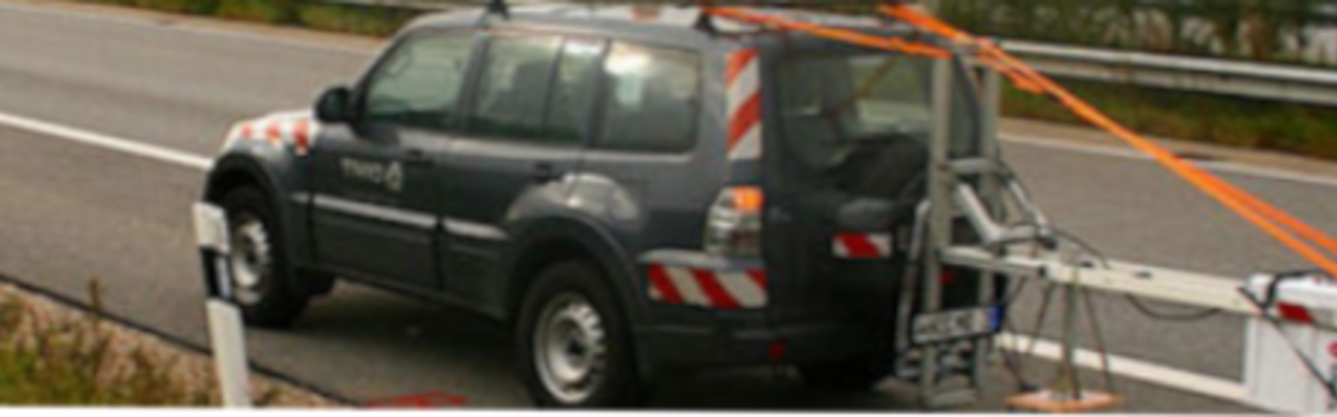
Depending on the task at hand, vehicle-mounted or mobile systems are used. This allows for the efficient surveying of large-scale routes during ongoing operations as well as targeted investigations in sensitive areas. All data is collected with georeferencing and is immediately available for further processing in planning and geographic information systems.
Condition Assessment of Traffic Areas and Infrastructure
For the analysis of roads and paved surfaces, ground-penetrating radar provides a comprehensive, high-resolution dataset. Data is collected using high-speed systems designed for use in traffic, so measurements can generally be taken without disrupting traffic flow.
The analysis provides detailed information on:
• The composition and thickness of individual layers
• The delineation of homogeneous and inhomogeneous sections
• The identification of structural changes such as widenings or additions
• Indications of structural weaknesses and damaged areas
• A data foundation for optimized drilling and sampling concepts
For detailed investigations in defined areas, area-wide scans using array systems can also be employed. These enable precise analysis of damage patterns as well as an object-specific assessment of critical structures. The results can be integrated into existing condition monitoring systems and digital infrastructure models.
Route Survey and Utility Detection
When planning utility and infrastructure networks, ground-penetrating radar facilitates early and continuous surveying along planned routes. The measurement data is recorded with precise location information and processed into a comprehensive subsurface model.
This allows for the early identification of:
• existing lines, cables, and pipes
• obstacles and foreign objects
• voids and geotechnical anomalies
• compacted and loose soil zones
This information helps reduce planning risks, support permitting processes, and efficiently prepare construction workflows.
Integration into Planning and Geodata Management
The data obtained from radar surveys is specifically combined with other exploration methods, such as soundings or localized soil investigations. This results in a robust, continuous model of the subsurface along sites or routes.
The results are processed so that they can be directly integrated into:
• Route planning and CAD systems
• GIS environments
• BIM-based planning processes
This makes them available to all project stakeholders as a consistent basis for decision-making. For greater exploration depths or complex issues, ground-penetrating radar can be flexibly combined with other geophysical methods.
Added value for your projects
The use of ground-penetrating radar provides insight into the subsurface—early on and without disrupting existing structures. This supports reliable planning, reduces uncertainties during construction, and improves the quality of decisions throughout all project phases.
Contact Form
Contact
Christian Holst
DMT ES HO
DMT Engineering Surveying GmbH & Co. KG
Am TÜV 1
45307 Essen
Tel.: +49 40 67587138 0
Mobil: +49 160 8882997
Mail: Christian.Holst@dmt-group.com